LOCAL-TIE
The realization of the International Terrestrial Reference Frame (ITRF) is the result of the combination of the reference systems calculated from the four space geodetic techniques: GNSS (Global Navigation Satellite System), VLBI (Very Long Baseline Interferometry), SLR (Satellite Laser Ranging) and DORIS (Doppler Orbitography by Radiopositioning Integrated on Satellite). To carry out the direct combination between the products of the different techniques, it is necessary to determine the relative positions (or local-tie vectors) between the instrument’s reference points at co-location sites (stations with multiple techniques installed).
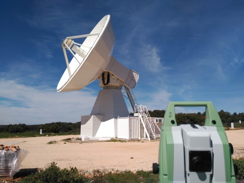
Local tie surveys are determined by using terrestrial measurements (direction and vertical angles, slope distances, and leveling) and GNSS observations (see Fig.1). An adequate methodology needs to be followed by surveyors and data analysts in order to determine the vectors at the millimeter level.

The first step is to design and deploy a local network of reference pillars in the site. This network allows the connection between the different reference points by means of terrestrial measurements. For each technique, it is needed to define the conventional reference point to which the measurements will be referred. In the case of GNSS and DORIS, the reference point are physical markers that can be directly observed by surveying methods, but this is not the case for VLBI and SLR. In these cases, the reference point is the intersection of primary and secondary axes, so it should be observed indirectly. At this aim, several targets are placed on the telescopes and surveyed from at least one station of the local network. The telescope is rotated in elevation and azimuth and in a post-processing step, the coordinates of the circles centers that are drawn by the targets are determined. Additionally, GNSS observations of the local network allow an alignment of the local tie solution to the ITRF.
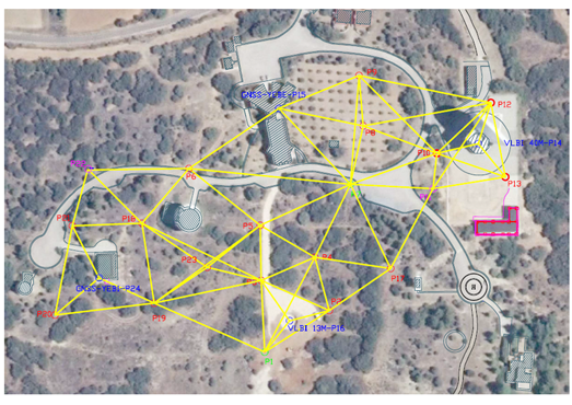
Based on the field observations, a least square adjustment of the local surveys is performed by data analysts, producing a SINEX file and an associated report. Finally, these products are provided to the ITRS Combination Centres (International Terrestrial Reference System) in order to be used for the ITRF production. In Fig. 2 it is possible to observe Yebes Observatory local-tie network, referencing the positions of the GNSS permanent stations (YEBE and YEB1), the RAEGE 13m radio telescope and the 40m radio telescope.

