GNSS - GLOBAL NAVIGATION SATELLITE SYSTEM
The Global Navigation Satellite System (GNSS) is a space geodetic technique that, using a constellation of satellites providing signals from space, transmits positioning and timing data to GNSS receivers.
Four GNSS constellations provide global coverage: GALILEO (EU), GPS (US), GLONASS (Russia) and BeiDou (China). But other non-global constellations exist, allowing positioning services at a specific area.
The performance of GNSS is assessed using four criteria:
- Accuracy: the difference between a receiver’s measured and real position, speed, or time;
- Integrity: a system’s capacity to provide a threshold of confidence and, in the event of an anomaly in the positioning data, an alarm;
- Continuity: a system’s ability to function without interruption;
- Availability: the percentage of time a signal fulfils the above accuracy, integrity, and continuity criteria.
This performance can be improved by regional satellite-based augmentation systems (SBAS), such as the European Geostationary Navigation Overlay Service (EGNOS). EGNOS improves the accuracy and reliability of GNSS information by correcting signal measurement errors and by providing information about the integrity of its signals.
WORKING PRINCIPLES
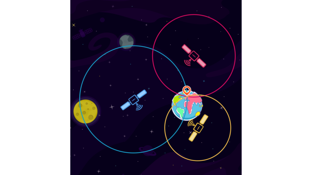
The positioning principle is based on solving an elemental geometric problem, involving the distances (ranges) of a user to a set of at least four GNSS satellites with known coordinates.
These ranges and satellite coordinates are determined by the user’s receiver using signals and navigation data transmitted by the satellites. The basic observable in a GNSS is the time required for a signal to travel from the satellite (transmitter) to the receiver. This travel time, multiplied by the speed of light, provides a measure of the apparent distance (pseudorange) between them. With four measurements of distances one can resolve 4 unknowns. For the end user these 4 unknowns are the 3 unknowns of his position (X, Y, and Z or Latitude, Longitude, and Height) and the clock error of his GNSS receiver. This principle is called trilateration (See Fig. 1).
The resulting user coordinates can be computed to an accuracy of several metres. However, centimetre-level positioning can be achieved using more advanced techniques.

[Ref.] https://www.reseau-teria.com/language/en/2021/12/20/positioning-by-gnss-gps-galileo-satellites-how-does-it-work/
INFRASTRUCTURE
GNSS comprises three main segments:
- Space segment: The Space Segment of the system consists of the GNSS satellites and radio signals emitted from space to the Earth.
- Control segment: The Control Segment consists of a system of tracking stations located around the world.
- User segment: The GNSS User Segment consists of the GNSS receivers (for example a smartphone) and the user community.
NETWORK
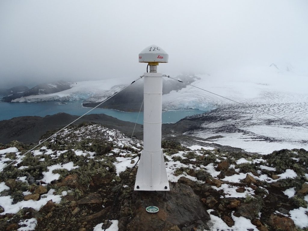
Regional or International networks of GNSS permanent stations exist around the world. A permanent station is a GNSS observing continuously, normally geodetic GNSS receivers are used (they are specially designed for obtaining the best precisions). Position of GNSS permanent stations can be achieved with millimetric-level accuracy.
Some examples of GNSS permanent networks are:
- The ERGNSS network, a Spanish public GNSS network with more than 130 stations around Spain, controlled by the National Geographic Institute of Spain. Position and time series of the stations are computed on a daily basis.

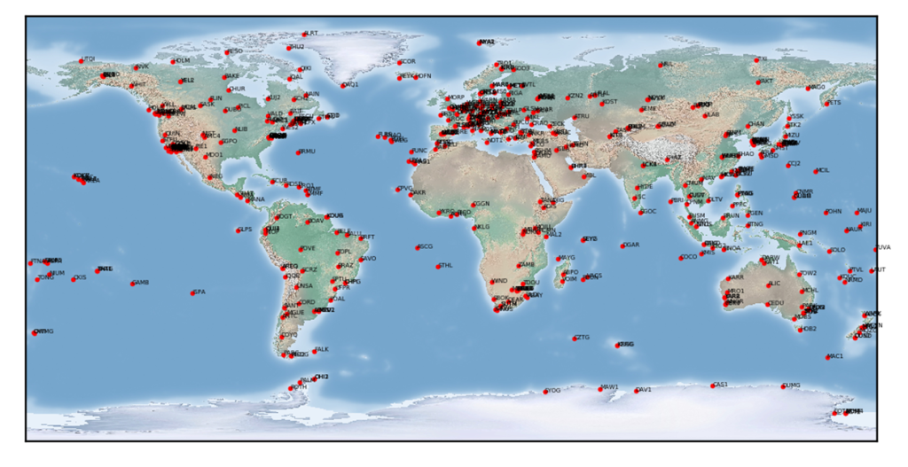
- The International GNSS Service (IGS) network has more than 500 stations around the world (See Fig.3). Currently, the IGS analysis centres provide the three-dimensional position and velocity solution of stations on a daily basis.

[Ref.] Image by igs.org
PRODUCTS
Direct products from GNSS are precise GNSS satellite ephemerides, positions, and velocities of stations in the global GNSS network, ERPs (Earth Rotation Parameters: polar motion and length-of-day), and satellite clock solutions. Other products derived from the GNSS data include troposphere Zenith Path Delay (ZPD) estimates (both dry and wet components) and global ionosphere maps (TEC values – Total Electron Content).
Time series can be computed from the stations of the permanent networks. These are very valuables for geodynamic purposes.
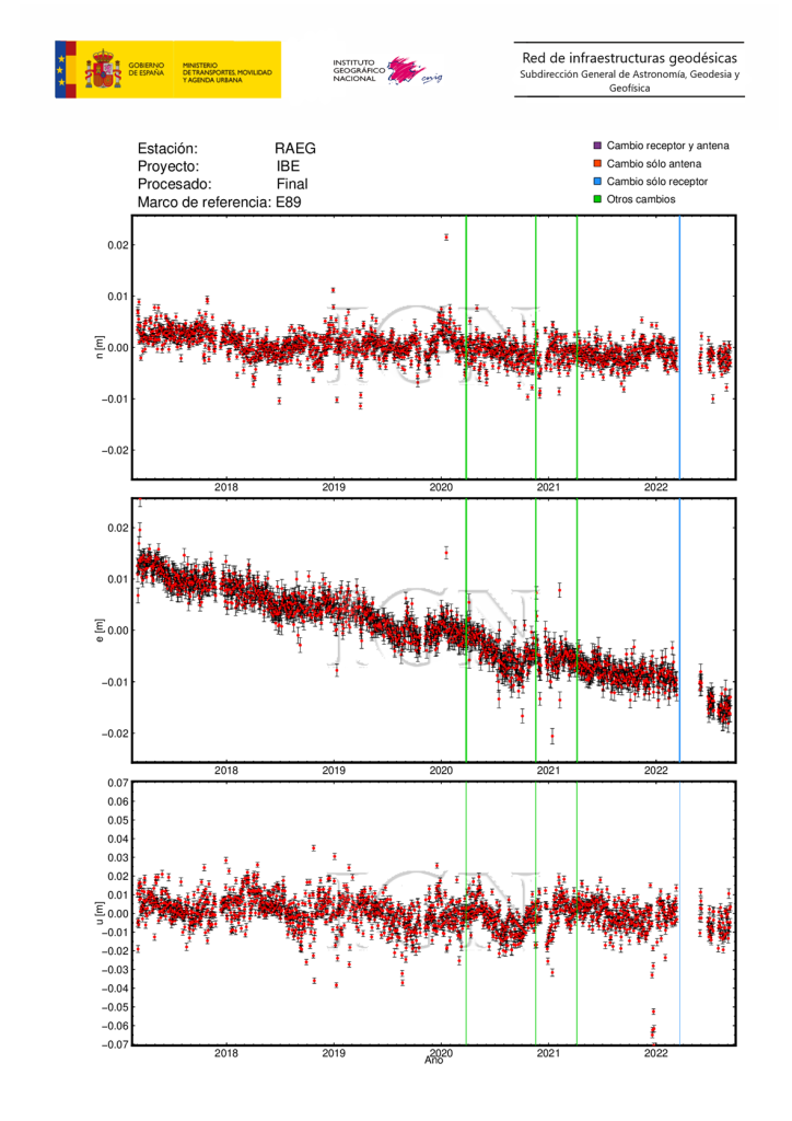
In Fig.4, the time series of RAEG GNSS station, in Santa Maria Observatory. In this series displacements in North (up in the picture), East (middle) and Up (down) directions are plot since the year 2017. Changes in equipment or other relevant events are marked with vertical color lines.

APPLICATIONS
GNSS observations are used worldwide in multitude of applications such as:
- Civil works and surveying;
- Mapping;
- Agriculture;
- Natural disasters research and alert;
- Support scientific research in realization of the International Terrestrial Reference Frame (ITRF), monitoring deformation of the solid Earth, monitoring Earth rotation, monitoring variations in the hydrosphere (sea level, ice sheets, etc.);
- Scientific satellite orbit determination;
- Monitoring the Earth’s ionosphere and troposphere;
- Time and frequency transfer.
